Dispatch of the latest on gold mining impacts across the Amazon
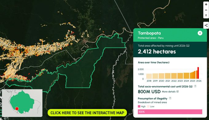
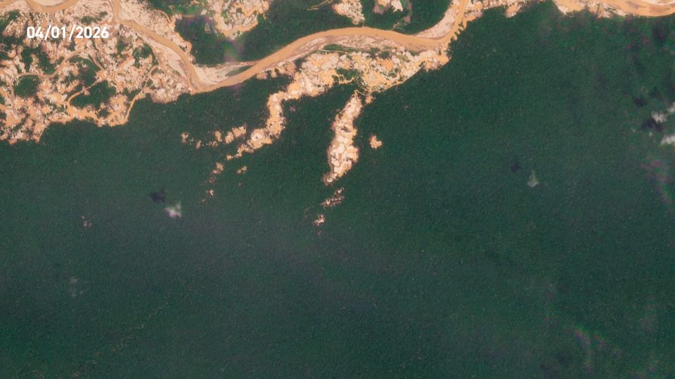
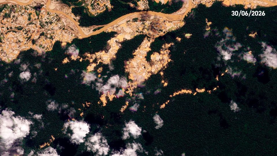
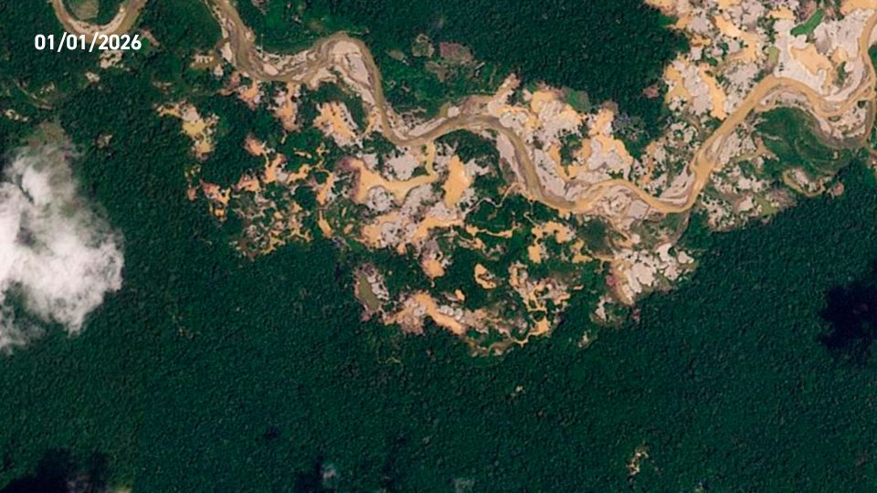
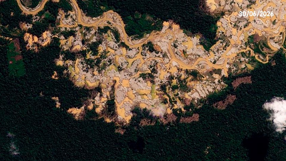
Recent expansion of illegal gold mining in Tambopata National-Reserve. Data ACCA, Planet.
Amazon Mining Watch | Panorama provides critical insights into the escalating threat of illegal gold mining across the Amazon. Based on AI-powered detection of mining scars anywhere in the basin using Amazon Mining Watch (AMW), a multi-partner platform led by Amazon Conservation, Earth Genome, and the Pulitzer Center, Panorama reports provide a data-driven perspective on the environmental challenges facing the world’s largest rainforest.
This quarterly Panorama report includes information on the previous two quarters (Q1 and Q2) of 2026, covering January through June. This report provides regional trends of gold-mining driven deforestation and key examples of new incursions into Protected Areas and Indigenous Territories previously untouched by mining, cases of resurgence of mining in those areas, and areas with persistent and accelerating mining deforestation.
As gold prices continue to rise, timely detection of new expansion of mining areas through a consistent, wall-to-wall methodology can support a swift and coordinated enforcement response from authorities across borders.
Scroll to read the report or download the PDF using the button below.
Regional trends of gold mining-driven deforestation
Key findings from January to June 2026:
Hectares in Brazil
Hectares in Peru
Hectares in Guyana
Hectares in Suriname
Hectares in Venezuela
Hectares in Ecuador
Hectares in Bolivia
Hectares in French Guiana
Hectares in Colombia
Gold mining expanded across all eight Amazonian countries and a French territory between January and June 2026, adding approximately 36,000 hectares of new mining area. This new expansion brings the total cumulative area impacted by gold mining across the Amazon to 1.149 million hectares.
Brazil registered the largest mining expansion area (12,700 ha), followed by Peru (8,100 ha) and Guyana (7,700 ha), as the clear top three. In the middle tier were Suriname (2,900 ha), Venezuela (2,600 ha), Ecuador (650 ha), and Bolivia (560 ha), and French Guiana (490 ha). Colombia had the least new gold mining deforestation (134 ha), but does have an emerging issue related to illegal gold mining along the Pure River (see MAAP #245).
Of this new mining expansion in 2026, 30% has occurred in Protected Areas (10,872 ha) and 15% in Indigenous Territories (5,502 ha).
NEW INCURSIONS ON PROTECTED AREAS OR INDIGENOUS TERRITORIES
This section lists areas with no mining detected since 2018 but where mining scars have been detected in the last two quarters, highlighting totally new—and highly likely to be illegal—incursions in areas designated for conservation or indigenous territories.
Detection polygons for each of these cases are visible on the Amazon Mining Watch geovisor, where the full time series of mining expansion since 2018 can be consulted. Where available, high-resolution Planet imagery is also provided, confirming the nature of the activity causing deforestation.
Under this category, only two new mining incursions were detected in the last two quarters, across legally recognized Indigenous territories and protected areas.
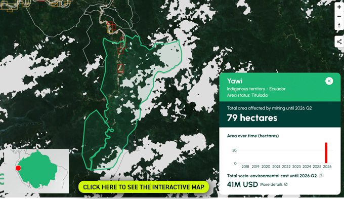
Yawi Indigenous Territory
ECUADOR
The Yawi Shuar-Achuar Center was granted 2,729 hectares of forest and protective vegetation in the upper Nangaritza River basin—located in Zurmi Parish, Nangaritza Canton, Zamora Chinchipe Province—under Ministry of the Environment Ministerial Agreement No. 022 (formalized in the Official Registry in May 2006). Note this area was covered in MAAP #243 (Case #2), as this Shuar center shares territory with the Upper Nangaritza River Basin Protection Forest.
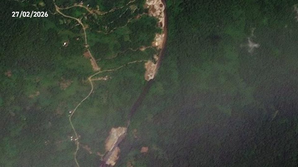
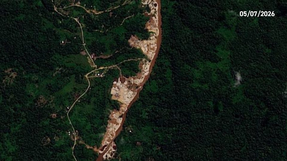
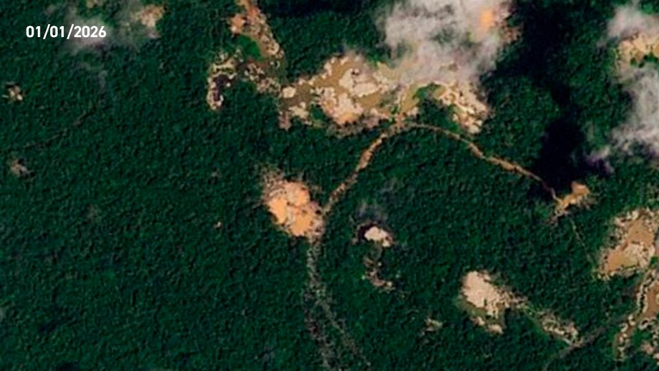
Mining update: In this case, the updated AMW models picked up new mining deforestation of 79 hectares that entered the territory in 2025 and expanded in 2026.
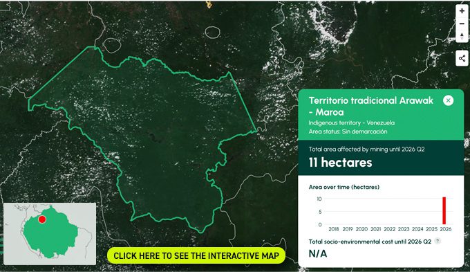
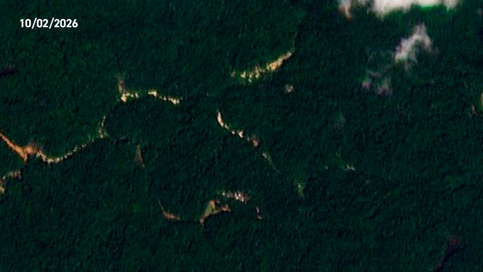
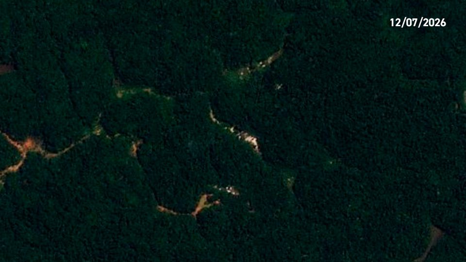
Arawak – Maroa Traditional Territory
VENEZUELA
Indigenous area of traditional use
RESURGENCE OF MINING DEFORESTATION IN PROTECTED AREAS AND INDIGENOUS TERRITORIES
This section lists protected areas and indigenous territories where new mining scars have been detected in the last quarter, and where no new mining scars had been detected in the past three quarters, indicating mining sites where activity had previously abated – possibly following enforcement operations – but has recently resurged.
Under this category, no areas were detected in the last two quarters.
PROTECTED AREAS AND INDIGENOUS TERRITORIES WITH PERSISTENT AND ACCELERATING MINING DEFORESTATION.
This section lists protected areas, indigenous territories with persistent mining-driven deforestation that have seen notable expansion in the past two quarters.
Many areas across the Amazon continue to experience gold mining-related deforestation, however the following 10 were selected for the persistent and accelerating character of this driver.
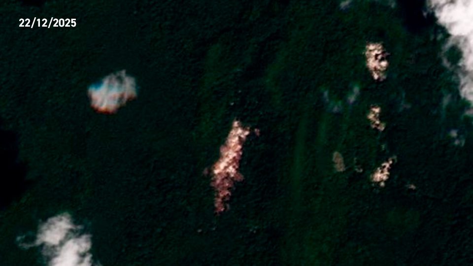
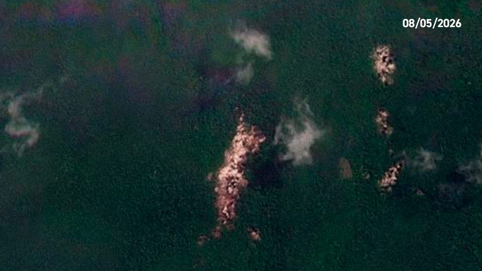
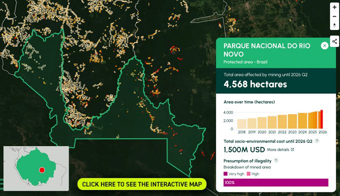
Rio Novo National Park
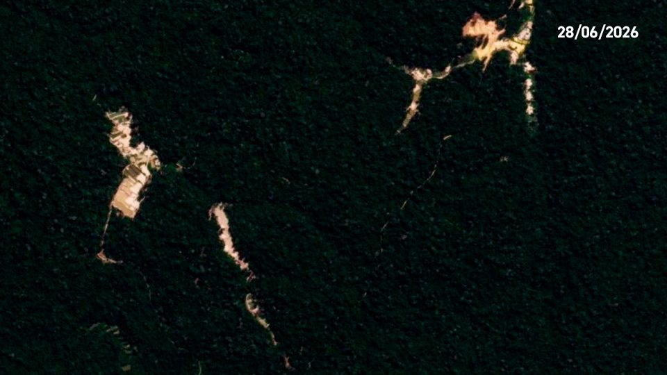
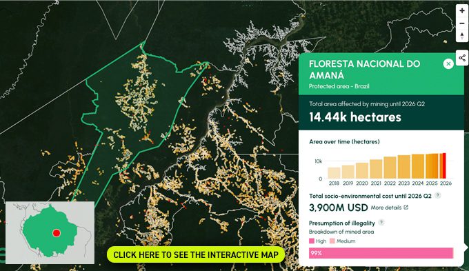
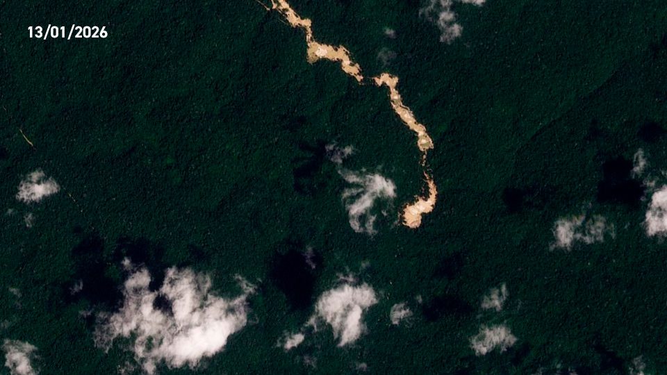
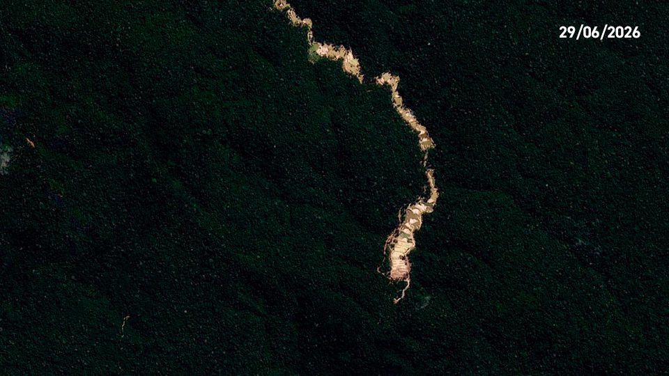
Amaná National Forest
BRAZIL
The Amaná National Forest was established in 2006 as a sustainable use conservation unit managed by ICMBio. Unlike fully protected areas, this category allows for sustainable forest management of resources and scientific research, while ensuring the conservation of biodiversity. Located in the state of Pará, in the Tapajós basin, the unit plays a strategic role in the mosaic of protected areas in the Amazon, safeguarding dense tropical forest ecosystems and traditional livelihoods in a critical environmental conservation zone.
Mining update: We recorded the new mining deforestation of 300 hectares in the national forest during first half of 2026. This area has experienced increasing gold mining deforestation for the past 4 quarters (Q3 2025 to Q2 2026). The cumulative mining impact is now 14,440 ha.
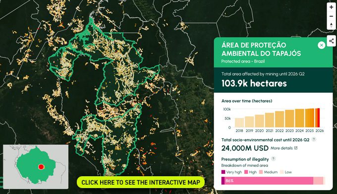
Tapajós Environmental Protection Area
BRAZIL
The Tapajós Environmental Protection Area (APA do Tapajós) was created in 2006 under the category of Sustainable Use. Designed to harmonize human occupation and sustainable resource management with environmental conservation, this extensive territory allows for private property and sustainable economic activities alongside conservation objectives. Located in the state of Pará, along the Tapajós River corridor, the APA serves as a buffer zone for the surrounding national parks and forests.
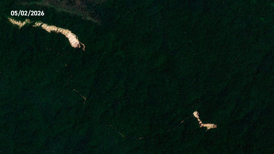
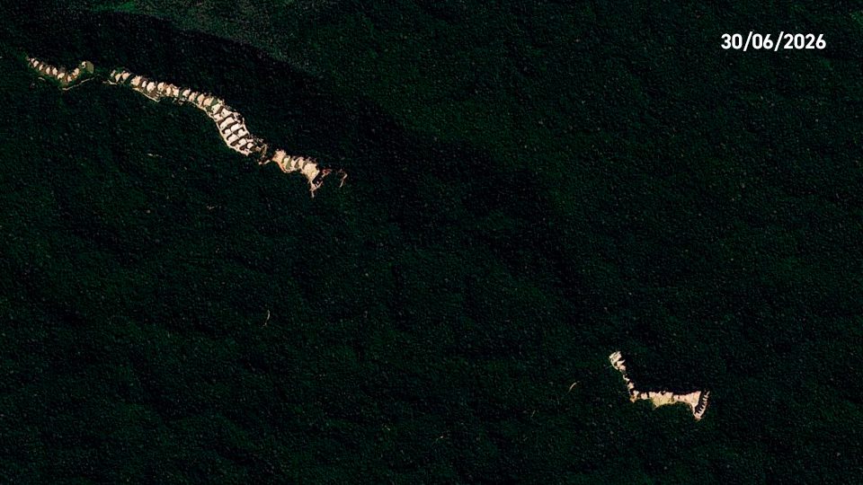
Mining update: We recorded the new mining deforestation of 1,200 hectares in the protection area during first half of 2026. The cumulative mining impact is now 103,900 ha.
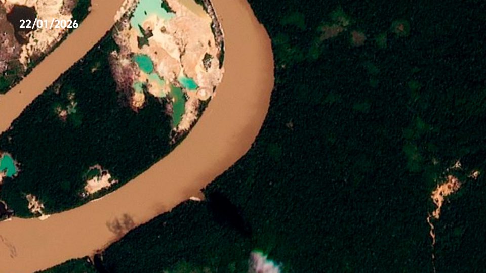
Tambopata National Reserve
PERU
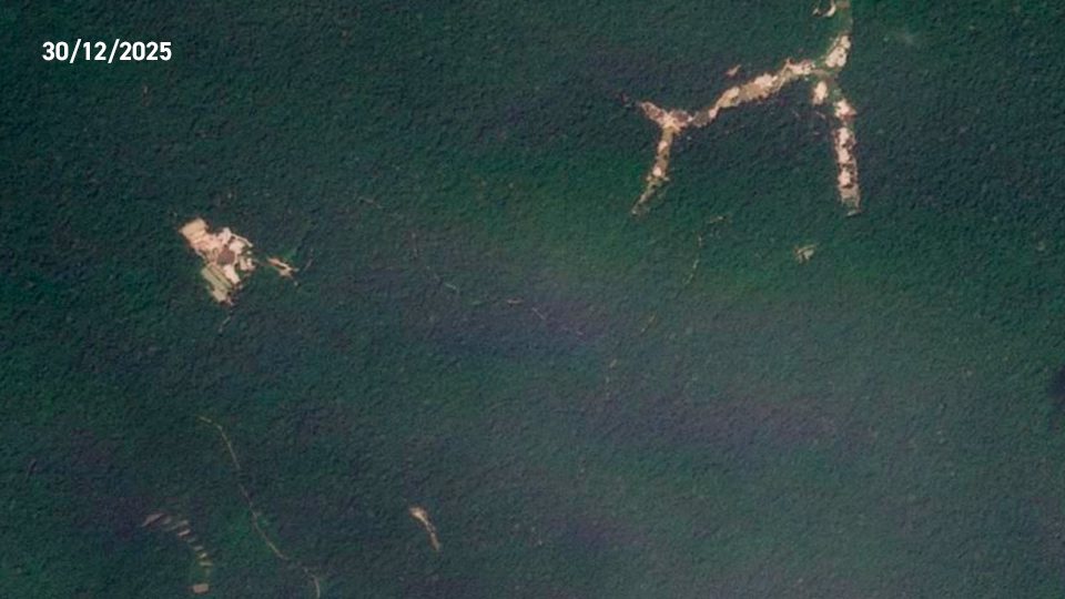
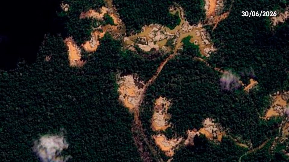
Tambopata National Reserve was officially established in 2000, by Supreme Decree No. 048-2000-AG. The territory is classified as an IUCN Category VI protected area, allowing for the sustainable use of natural resources by local communities. The reserve safeguards critical lowland Amazonian rainforest and is renowned for its exceptional biodiversity.
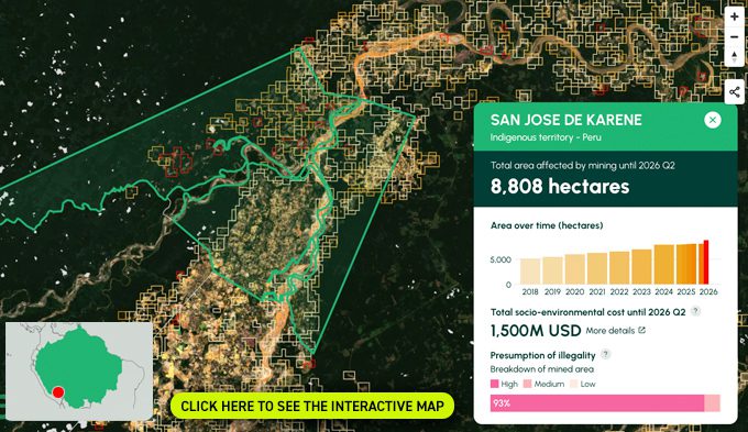
San José de Karene
PERU
A large portion of the illegal mining deforestation in the southern Peruvian Amazon is occurring within the territory of the Native Communities. These Native Communities are part of an articulated federation known as FENAMAD (Native Federation of the Madre de Dios River and its Affluents), which is the regional representative organization of the indigenous peoples of the Madre de Dios River basin. FENAMAD defends the fundamental and collective rights of indigenous peoples and native communities, including indigenous peoples in situations of isolation and initial contact. See MAAP #208 for more information.
Kotsimba
PERU
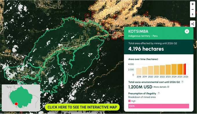
A large portion of the illegal mining deforestation in the southern Peruvian Amazon is occurring within the territory of the Native Communities. These Native Communities are part of an articulated federation known as FENAMAD (Native Federation of the Madre de Dios River and its Affluents), which is the regional representative organization of the indigenous peoples of the Madre de Dios River basin. FENAMAD defends the fundamental and collective rights of indigenous peoples and native communities, including indigenous peoples in situations of isolation and initial contact. See MAAP #208 for more information.
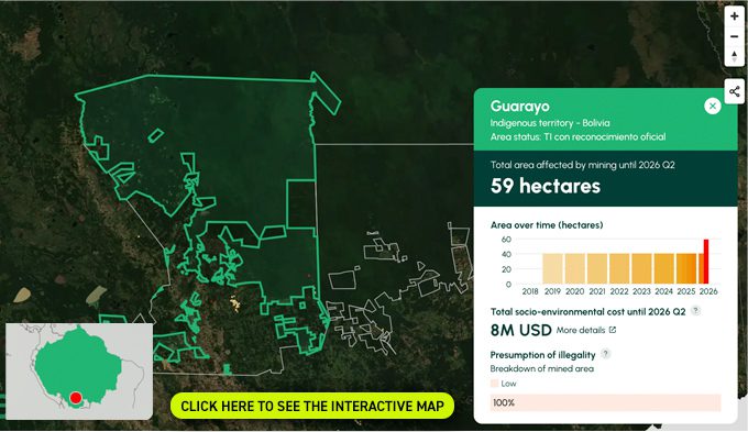
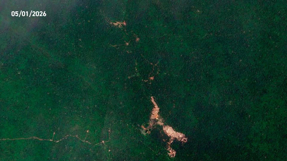
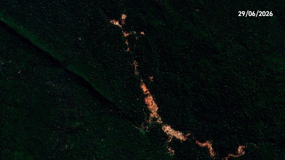
Guarayo Original Indigenous Campesino Territory
BOLIVIA
The Guarayos Indigenous Territory in Santa Cruz, Bolivia, is the ancestral land of the indigenous Gwarayu people. Spanning over one million titled hectares between the Amazon and Chiquitania. Its economy relies on subsistence agriculture and forestry. Today, deforestation, recurrent forest fires, and illegal land grabs threaten its rich biodiversity, legal security, and the cultural survival of the Gwarayu.
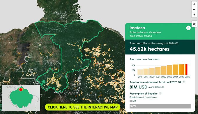
Imataca Forest Reserve
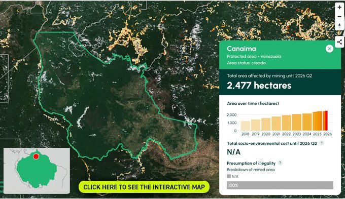
Canaima National Park
VENEZUELA
Canaima National Park, established by Presidential Decree No. 770 in 1962 and expanded in 1975 to its current 30,000 km², is one of Venezuela’s Special Administration Regime Areas (ABRAE) and was inscribed as a UNESCO World Heritage Site in 1994. Managed by INPARQUES with co-management arrangements involving Pemón Indigenous communities, the park lies in Bolívar State’s Gran Sabana and protects the ancient tepuis of the Guiana Shield. It safeguards the upper Caroní River basin, vital for Venezuela’s hydroelectric generation, and is home to Angel Falls (Kerepakupai Vená), the world’s tallest waterfall at 979 meters. Beyond its ecological and cultural significance, Canaima has been highlighted by civil society organizations at the 48th session of the UNESCO World Heritage Committee in South Korea due to growing concerns over mining impacts within this protected area.
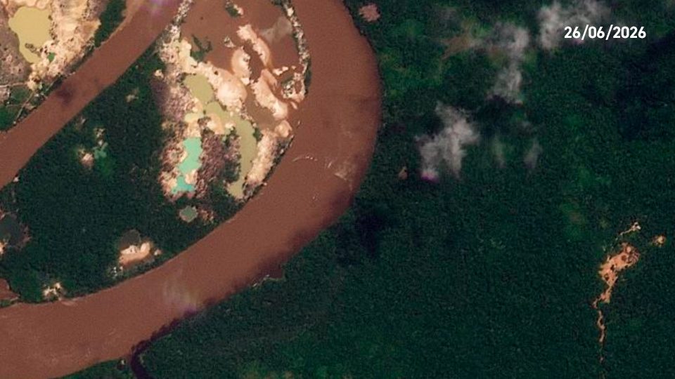
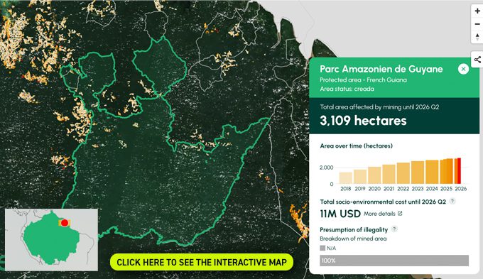
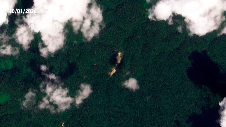
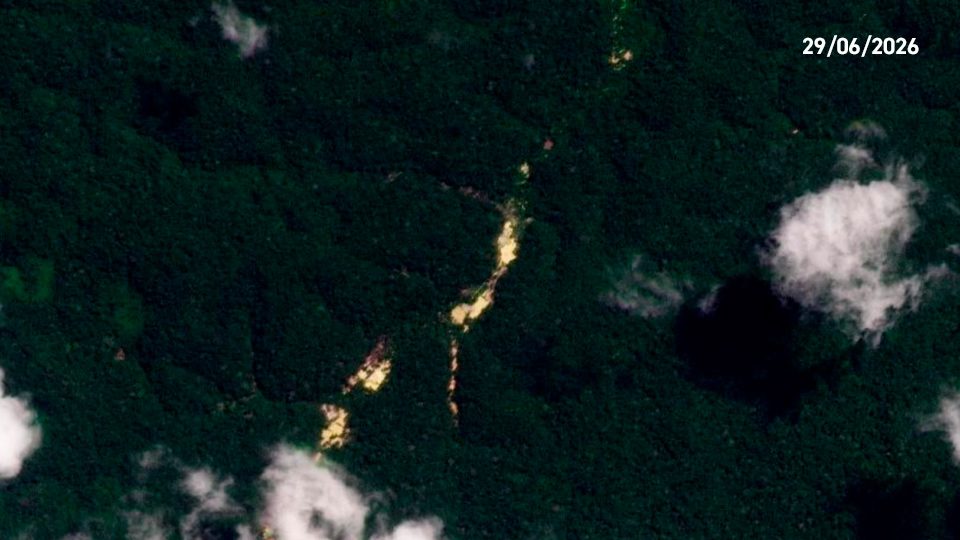
Amazonien de Guyane National Park
FRENCH GUIANA
In MAAP #225, we reported that this park is a significant carbon sink and has among the highest levels of carbon relative to other protected areas across the Amazon.
VIEW THESE AREAS AND MORE
ON THE AMAZON MINING WATCH PLATFORM
Conclusion
The findings of this report reveal the continuous expansion of mining-related deforestation, encroaching upon protected areas and indigenous territories. The persistent and pervasive nature of this threat underscore the escalating crisis of illegal gold mining in the Amazon. Consistent, data-driven monitoring provided by Amazon Mining Watch Panorama is crucial for understanding the scope of the problem and to promote accountability. Amazon Mining Watch and its partners will continue to provide quarterly and yearly updates about trends in gold mining expansion in the Amazon, information about the presumed illegality of these activities and their estimated socioenvironmental impact.
Methodology of monitoring systems
For Amazon Mining Watch, the mine detector is an artificial neural network, which we train to discriminate mines from other terrain by feeding it hand-labeled examples of mines and other key features as they appear in Sentinel-2 satellite imagery. The network operates on square patches of data extracted from the Sentinel-2 L1C data product. Each pixel in the patch captures the light reflected from Earth’s surface in twelve bands of visible and infrared light. We average (median composite) the Sentinel data across a period of many months to reduce the presence of clouds, cloud shadow, and other transitory effects. During run time, the network assesses each patch for signs of recent mining activity, and then the region of interest is shifted by half a patch width for the network to make a subsequent assessment. This process proceeds across the entire region of interest.

Acknowledgments
This report was made possible by the generous support of the Gordon and Betty Moore Foundation.